Courses
2.1 Introduction
This section introduces the reader to maps that identify the location of commodities being extracted. The Canadian Government has been producing Map 900A since 1947. The series of maps is entitled “Principal mineral areas, producing mines, and oil and gas fields in Canada” and shows the location of significant producing mines, and Oil and Gas Fields, in a given year. The commodities list was developed by searching through these maps. A search for maps is an easy first step for anyone looking for commodities mined in a particular area.
Natural Resources Canada (NRCAN) stores “pdf” or “jpeg” copies of these maps which can be downloaded for free from their website. One way to find these maps is to perform a basic search using the words “pdf 900A maps”. Zip files can be downloaded in English or French. The maps are very large, as shown in Figure 3, and currently list all producing Oil and Gas Fields and Producing Mines in Canada. To see a zoomed in version of Figure 3
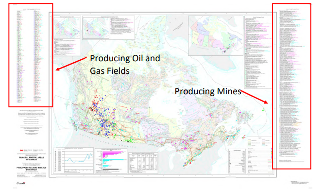
Figure 3. Sample of map 900A. Dots on map refer to locations of producing commodities (Natural Resources Canada, 2015)
NRCAN has also produced an interactive on-line version of Map 900A for Canada. A simple search of “The Atlas of Canada – Minerals and Mining” should bring up links to this map. A screen grab is shown in Figure 4. The data used to produce this map can be downloaded, and this was done to produce the maps in Appendix 2. A key observation to make from these figures is that economically viable resources of minerals are found in all provinces and territories in Canada except for Prince Edward Island. These maps highlight a general descriptor for mineral deposits as either industrial minerals (Figure 2-1), fuel minerals (Figure 2-2) or metallic minerals (Figure 2-3 and Figure 2-4). The interactive maps are scaled to the screen and offer interactive features, which is not the case of Figure 3.
These 900A resources list approximately 500 deposits that have been producing in Canada since the year 2000. The Mines Handbooks (Northern Miner Press, 1934 to Present) are another source of mines names with a focus towards metallic and mined fuel minerals. That is, the focus is on the oil sands and not petroleum wells. Other organizations have also produced maps of mine locations such as by QuebecQC.com (n.d.), Ontario Mining Association (2017), and Mining Association of British Columbia (2017).
These maps series provide transparency in tracking mining operations. Ultimately in Canada, it is the government that holds the responsibility for allowing certain lands to be operated on and for resources to be extracted. The Government of Canada gives free access to their information and dedicates funding to display mining data and in doing so, this is a visual platform for communicating land used data with the public.
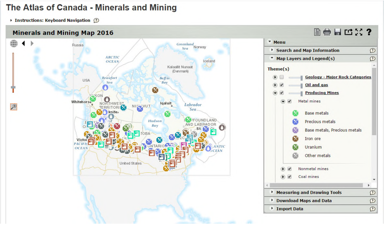
Figure 4. Screen grab of the Atlas of Canada – Minerals and Mining Map, Year 2016 (Natural Resources Canada, 2017)
Lesson List
Module 2- Canadian Mines in the 21st Century
Teachers Info

Donna Beneteau
- Specialist: Geology
- Experience: Over 20 Years
- Website: http://beyondgeology.com
-
Her career and volunteering since she graduated from Geological Engineering in 1990 has been related to the mining industry.