Courses
2.5 How Canada Developed through Mining
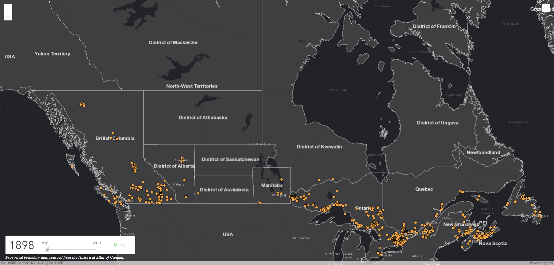
From the placement of its towns and rail lines to its growth as one of the world's leading economies, much of Canada's historical development has been driven by the search for and production of its natural resources. Mining, in particular, has had a long and widely influential impact on the growth of Canada. These maps show the mines at various times in Canada’s history and were selected based on their significance to CIM. The data used was from an early spreadsheet used to develop the Hub. In 1898, the Canadian Mining Institute was incorporated by an Act of the Parliament of Canada. In the early days, the 1000 mines are located where the population is. The Canadian Pacific Railroad was completed in 1885, connecting eastern Canada to BC. Notice the Districts of Alberta, Saskatchewan, Keewatin and Manitoba.
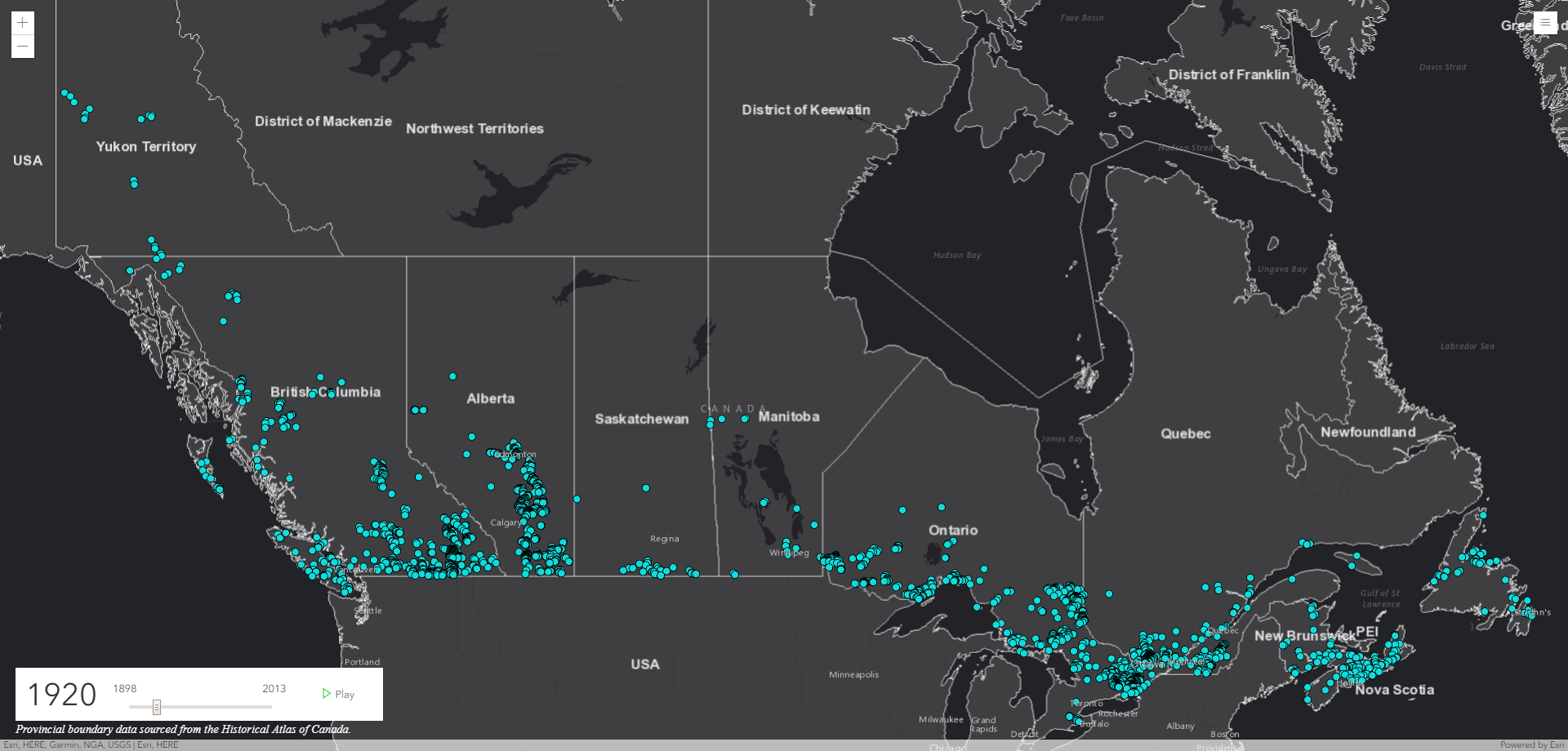
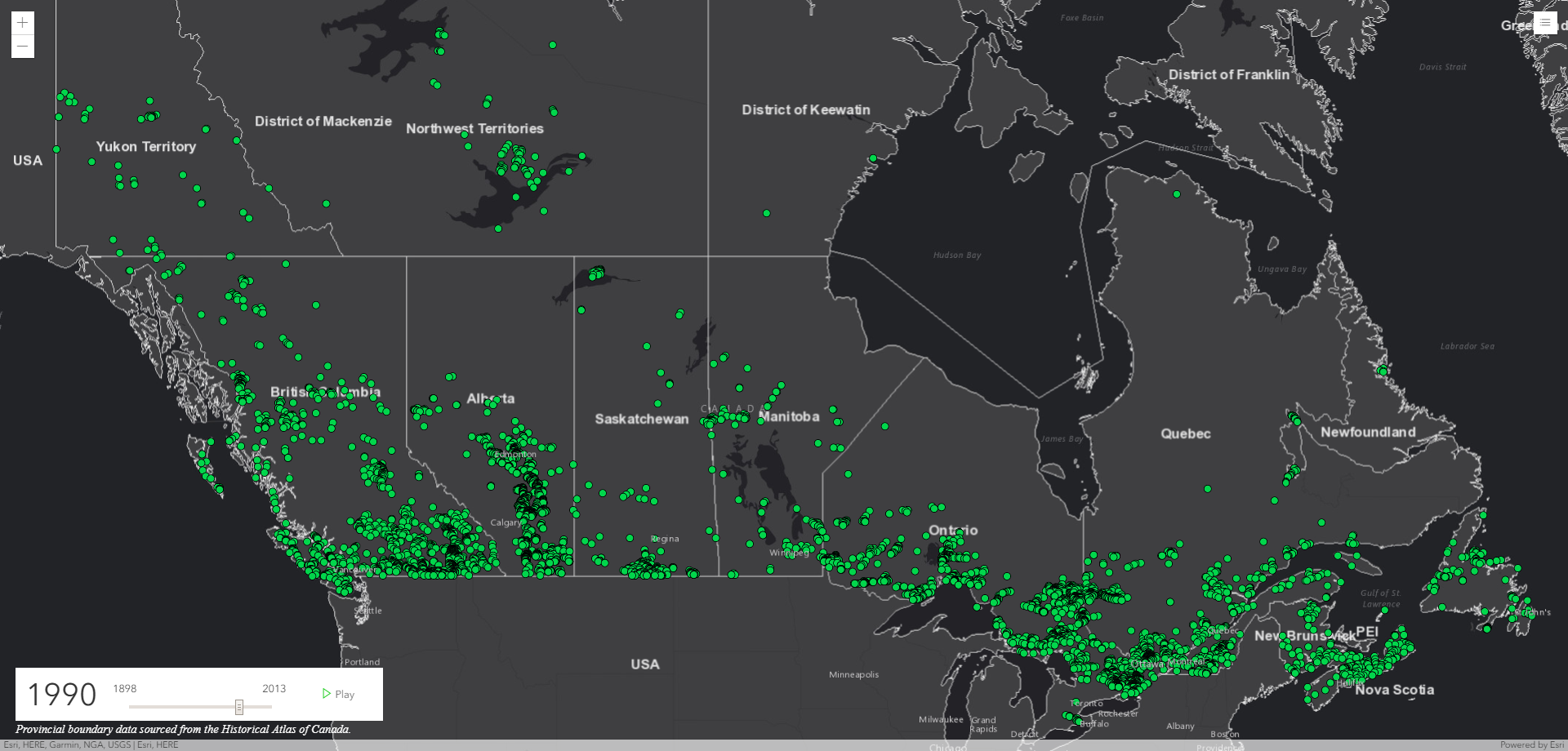
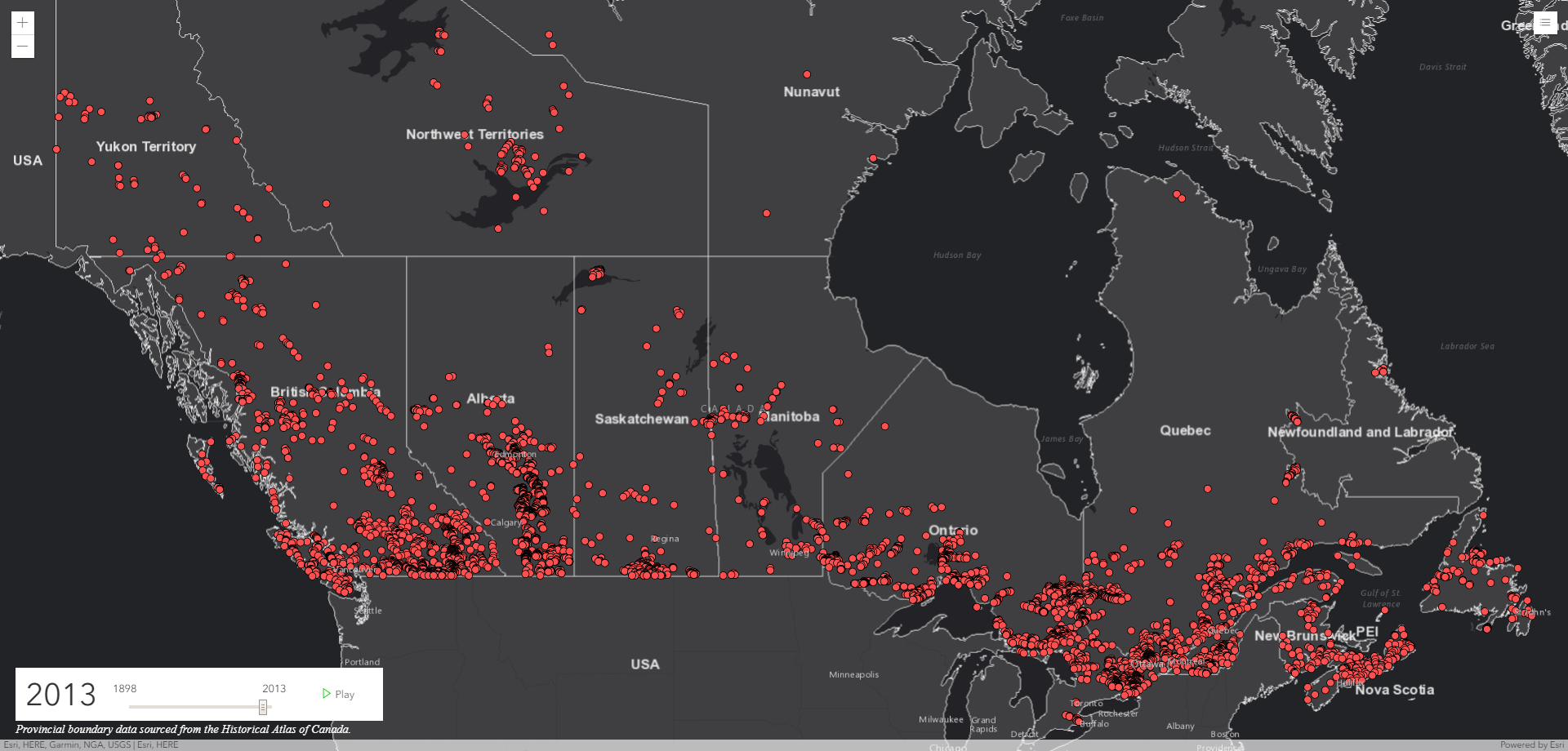
In 1920, CIM’s name was changed to the Canadian Institute of Mining and Metallurgy. The provinces of Saskatchewan and Manitoba are formed and the incomplete dataset has a total of 3000 mines up until this time. The population is starting to follow the east-west rail lines and this represents an increase of approximately 90 mines per year since 1898. As air travel developed through the 1900’s, so did the number of mines in the far North. Since 1920, there is an average increase of 57 mines per year to get to the 7000 dots on the map. Finally in 2013, there are a total of 7160 dots on this map which shows that the average number of mines being added per year from 1990 has decreased to an average of 7.
Lesson List
Module 2- Canadian Mines in the 21st Century
Teachers Info

Donna Beneteau
- Specialist: Geology
- Experience: Over 20 Years
- Website: http://beyondgeology.com
-
Her career and volunteering since she graduated from Geological Engineering in 1990 has been related to the mining industry.